Mitchell River National Park
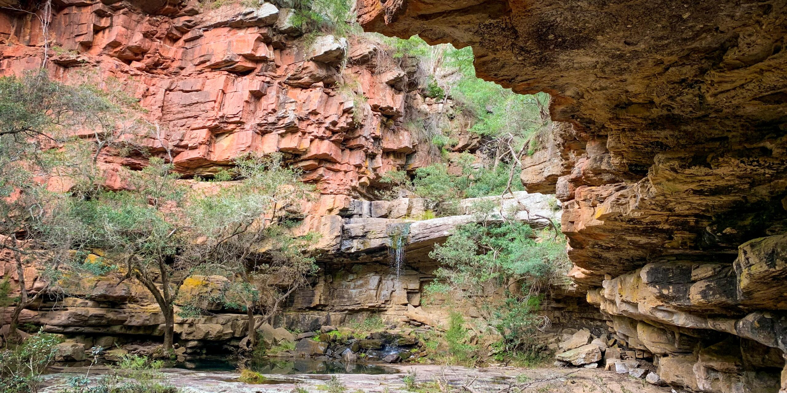
The Gunaikurnai have a deep spiritual connection with the Mitchell River landscape through ceremony, songs and dreaming. For Gunaikurnai many spirits still live in the landscape, their signs in the rocky outcrops and other features. Rock art, rock shelters, canoe trees, surface scatters, men’s and women’s sites, campsites, massacre sites, burials and many sacred places occur within the park.
The area in and around the Mitchell River Gorge was a major stopping off point for Gunaikurnai travelling between the high country and the lowlands. The rocky terrain, steep dropoffs and lookout points provided excellent vantage points for safety and defence. There are important places throughout this park — Angusvale was a good source of food, medicine and materials, Billy Goat Bend had reliable water. Deadcock Den is an important women’s place. It was, at one time, proposed as the site of a mission but it was found to be too cold in winter so Lake Tyers was chosen instead.
Mitchell River National Park is one of the fourteen jointly managed parks and reserves within Gippsland.
The Joint Management Agreement recognises that GunaiKurnai people hold Native Title and maintain a strong connection to Country. As custodians of the land, they are the right people to speak for their Country.
These parks and reserves are cultural landscapes that
continue to be part of GunaiKurnai living culture.

Den of Nargun
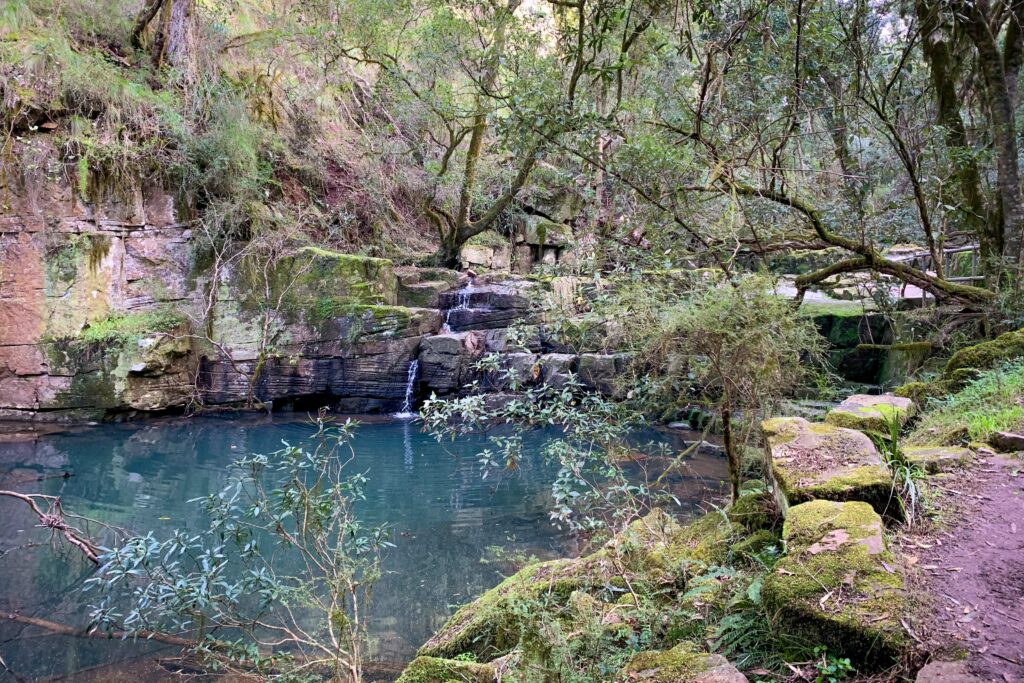
The Den of Nargun on Woolshed Creek, a small tributary of the Mitchell River, is of great cultural significance and is known as a women’s place. According to Gunaikurnai lore the Nargun is a large female creature who lives in a cave behind the waterfall. Stories were told around campfires about how the Nargun would abduct children who wandered off on their own. The Nargun could not be harmed with boomerangs or spears.
These stories served the dual purpose of keeping children close to the campsite and ensuring that people stayed away from the sacred cave. It is a place of women’s initiation and learning ceremonies, and traditionally Gunaikurnai men are not allowed to enter the area of the Den of Nargun and the Woolshed Creek valley.
We ask visitors to acknowledge this sacred site by respecting the surrounding environment when you visit, and by not entering the cave.
Mitchell River National Park covers 14,394 ha of land surrounding the Mitchell River Gorge. It was declared in 1986 under Schedule Two of the National Parks Act by amalgamating the former Glenaladale National Park with other areas of public land. Additions of 2,350 ha were proclaimed in 2002, including land on the eastern side of the Mitchell River north of Hortons Track, and the purchased Mitchelldale property north of Angusvale. A further acquisition of 145 ha near Mitchelldale was incorporated into the park in 2012.
The park is listed in Category II (National Parks) of the International Union for the Conservation of Nature protected area categories and the United Nations’ List of National Parks and Equivalent Reserves. Category II areas are large natural or near natural areas set aside to protect large-‐scale ecological processes, along with the complement of species and ecosystems characteristic of the area, which also provide a foundation for environmentally and culturally compatible spiritual, scientific, educational, recreational and visitor opportunities.
The Mitchell River is protected as a Heritage River under the Heritage Rivers Act 1992 (Vic.) in recognition of its high conservation value, the naturalness of its flows, the relative intactness of the entire river system, and its significance for the Gippsland Lakes. It is the largest free-flowing river in Victoria in terms of annual flow, and is free of water diversions and barriers that affect the movement of native fish. The Mitchell River is an important example of the large scale river systems that were once widespread in south-eastern Australia (LCC 1991).
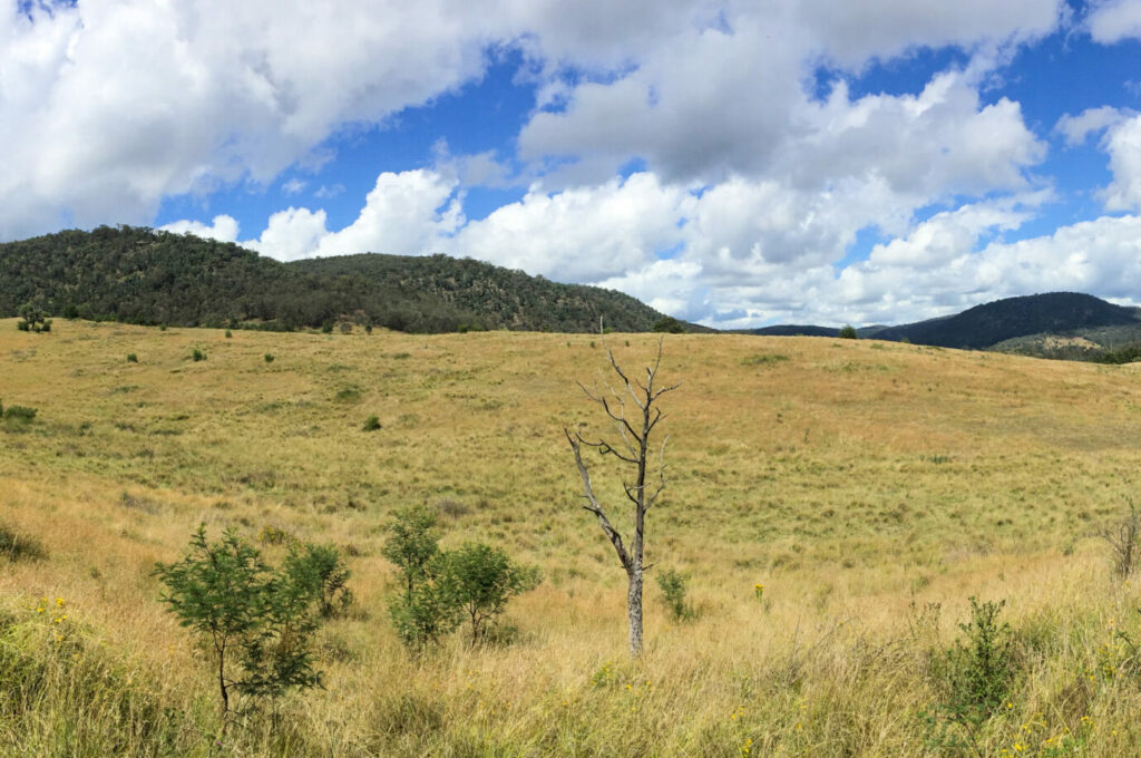
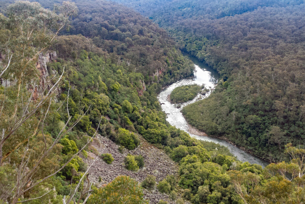
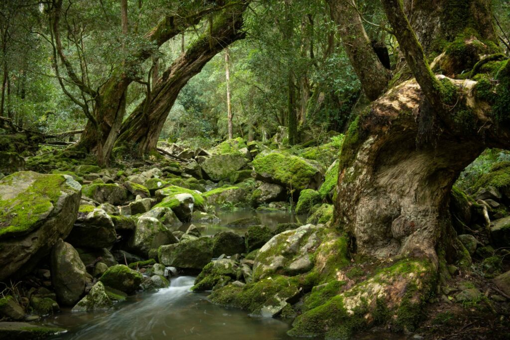
The park consists of rugged, moderately elevated terrain that is mostly forested. It occupies an intermediate position between the Victorian Alps and the Gippsland Lakes and coastal plains. Lowland Forest predominates in the southern part of the park and Shrubby Dry Forest covers most of the northern section. The deeply incised Mitchell River Gorge is a spectacular landscape, and the topography includes narrow sheltered gullies supporting rare vegetation types such as dry rainforest, warm temperate rainforest and gallery rainforest.
The park and gorge was a stopping off point for Gunaikurnai travelling to the high country. Today it provides an easily accessible entry into the fringes of the Victorian Alps and a sense of remoteness from the plains due to the enclosed gorge and valleys.
The park is used by outdoor education groups and tour operators for overnight rafting and walking through the Mitchell River Gorge. The open valleys in the north of the park provide excellent vehicle-based bush camping and are heavily used in peak periods. The lack of river crossing points in the park creates a geographical east-west divide that influences visitor access and usage patterns as well as park management operations.
The landscape of the park is shaped by the river, which is characterised by a network of valleys, steep cliffs and gorges that create a spectacular landscape. The Mitchell River Gorge, Sandy Creek, and Tabberabbera are of state geological and geomorphological significance. Undisturbed forests and catchments of high conservation significance make up approximately 65% of the park.
The park contains a range of significant vegetation communities, many of which are rare, vulnerable or endangered including gallery rainforest, dry rainforest, warm temperate rainforest, plains grassy forest, dry grassy woodland, dry valley forest, and riverine escarpment scrub. The southernmost occurrence of endangered dry rainforest, dominated by Kurrajong, is on the rocky slopes of the Mitchell River Gorge. These stands are at the westernmost limit of their distribution in Victoria. Silvertop Ash dominates the open forest community on the broad, flat ridge tops, while gum and stringybark species are prevalent on sheltered slopes and drainage lines. Giant Kanookas grow along the river banks amid a tangle of vines and ferns in the well-developed stands of warm temperate rainforest. Sweet Pittosporum, Lilly Pilly and Yellowwood grow in the moist gullies of the park. A drier forest of wattle and eucalypt predominates on the ridges above the river.
Mitchell River National Park is on the Country of the Brabralung clan. The creation of the national park in 1986, and the designation of the Mitchell River as a Heritage River in 1992, formalised Government policy decisions to give the area greater protection, and ended periodic proposals to dam and regulate the river.
The park has been managed since 1998 in accordance with the previous management plan (Parks Victoria 1998). However, recovery from large-scale bushfires in the alpine area north of the park and in East Gippsland, and environmental pressures and recreational demands in the Gippsland Lakes, have influenced regional park management priorities and resourcing in the region over the last decade or more.
Joint management provides a new impetus to enhance the management of Mitchell River National Park. The concept of ‘Caring for Country’, by managing natural, cultural and social uses of the park in a more integrated way, provides the basis for this enhancement. The health and condition of the park is stable or improving following the incorporation of recent additions and inliers, but faces several threats, especially from Sambar Deer and the stresses of climate change.
Highly significant rainforest remnants are at risk. Cultural sites need to be mapped and defined to protect them and avoid impacts from visitors. Access and facilities for campers in the north of the park can be improved. Camping in the Mitchell River Gorge needs to be monitored, and management of waste, fires and other issues is needed in partnership with river users to protect water quality, vegetation and cultural sites.
The Gunaikurnai have a deep spiritual connection with the Mitchell River landscape through ceremony, songs and dreaming. For Gunaikurnai many spirits still live in the landscape, their signs in the rocky outcrops and other features. Rock art, rock shelters, canoe trees, surface scatters, men’s and women’s sites, campsites, massacre sites, burials and many sacred places occur in the park. However, Gunaikurnai cultural values have not been systematically inventoried and were not incorporated in the zoning scheme of the previous park management plan. The zoning in this new management plan redresses that shortcoming.
The Gunaikurnai Whole of Country Plan (GLaWAC 2015) sets out the following management priorities for the park:
• restricting where camping can occur to protect significant cultural sites
• restricting four wheel drive access in sensitive areas
• ensuring the Gunaikurnai are consulted on any new walking tracks or roads that are being built, to make sure cultural values are protected
• giving Gunaikurnai first preference for all future and renegotiated tourism operations in the National Park.
While recognising these priorities, this joint management plan sets out actions that are consistent with and limited to the terms of the 2010 Recognition and Settlement Agreement. The Den of Nargun is one of the most conspicuous examples of Gunaikurnai cultural heritage in the parks and reserves in the RSA area. However, the cultural significance of the broader park has not been presented or promoted well to the wider community.
Overnight walking and rafting trips through the Mitchell River Gorge are among Victoria’s best adventure recreation and environmental education experiences, but cultural heritage forms little or no part of that experience. There is an opportunity to add cultural education to those experiences, initially through better information and progressively through the active participation of Gunaikurnai interpreters and guides, both inside the park and during pre-visit phases.
In the northern valleys, the historic homestead sites at Angusvale and Mitchelldale can be managed and presented to campers and others in a way that makes clearer the full richness of the occupation and settlement of the Mitchell River Country
Click here to read the full Joint Management Plan for Mitchell River National Park
